Heahflod
"Heahflod" in Old English directly translates to "high flood," a phrase that functioned much like "high tide" does today, denoting the maximum height of the sea during a tidal cycle. In the Anglo-Saxon period, "flod" (flood) and "ebba" (ebb) were the main terms for the rise and fall of the sea, with "heahflod" (high flood) used poetically and practically to describe the peak of the tide. As the tide reached its highest point, I watched what changes unfold. Here’s what I recorded during a sunrise and later afternoon high tide during the course of 24 hours.


High Tide
At the beach where I bird for shorebirds, there is a cut—a channel shaped, enlarged, and reshaped by coastal storms, wind, and water. It is ever-changing. At low tide, it forms a delta of rivulets as the oysterbeds and clumps of marsh grass reappear with the receding tide. Now the tide is rising, and within an hour or so it will be high tide. At high tide, the water in the cut or channel will rise to over my head, likely 6 feet or so. On this November afternoon the tide is gentle; the waters of Port Royal Sound, where it meets the Atlantic Ocean, are calm.
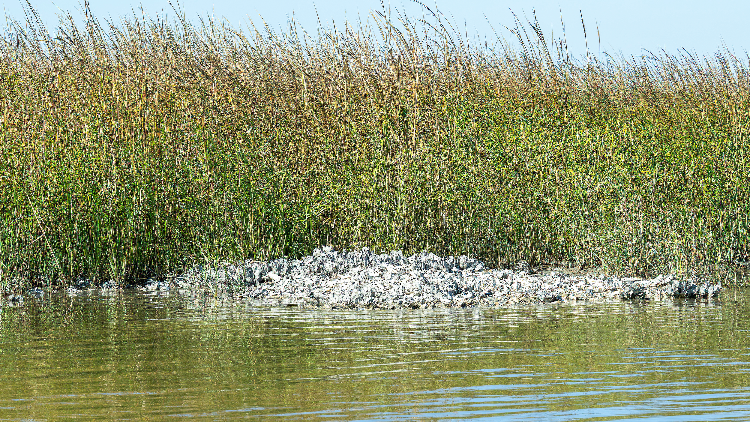
Oysterbed being submerged by the rising tide.
Field Notes: What I Hear and What Birds I See at High Tide
What I hear: waves softly lapping against the sandbar and an easy tide coming in. The tinkling of sand and shell deposits as they’re tossed by the waves. A soft breeze. The hum of boat engines in the sound. Birdsong from the forest: Red-winged Blackbirds, the calls of a Northern Flicker and a Red-bellied Woodpecker.
What I see: Black Skimmers are on the move. At low tide, they come to rest and feed in the delta, skimming the waters for fish in their unique low flight. With the movement of high tide, the flock slowly sections off and flies southeast to a larger sandbar to rest again. They are starting to migrate that way now, along with a mixed flock of Laughing Gulls and Ring-billed Gulls. I see butterflies and dragonflies in flight. I see a small group of six White Ibis flying into the marshes on the other side of the sand dunes. They now alternate between flying inland and to a large island of marsh grass that remains dry at high tide. I spot the ibis there, resting and preening. Suddenly there is a squabble, and one emerges in flight with a very large crab in its beak.


I see a disturbance of bubbles in the incoming tide and channel as a school of small fish hugs the sandbar shoreline and swims up into the channel. The velocity of the incoming tide has picked up.

School of small fish swimming into the channel with the incoming tide.
Least Sandpipers
The following morning, I returned to the same spot at the time of highest tide. I found a flock of Least Sandpipers foraging among the decaying marsh grasses and pluff mud that weren’t submerged by the tide. They moved quickly back and forth along the wrack line—some feeding, some resting.
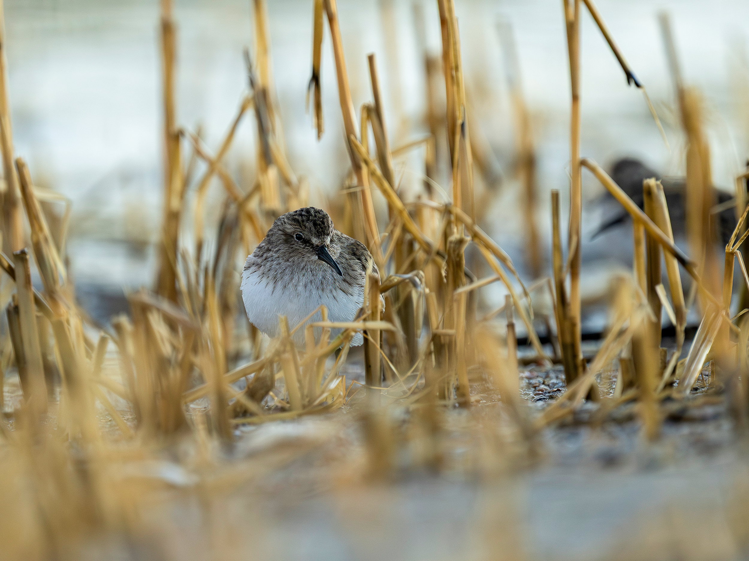
Least Sandpiper foraging along the wrack line at high tide.
The rise and fall of the tide sets the rhythm for everything at the shoreline. Each change in water level shifts where birds go, where they find food, and where they rest. As the tide goes out, the flats and deltas open up for feeding. When the water returns, birds move to higher ground, gathering on sandbars or patches of marsh grass that remain above the flood.
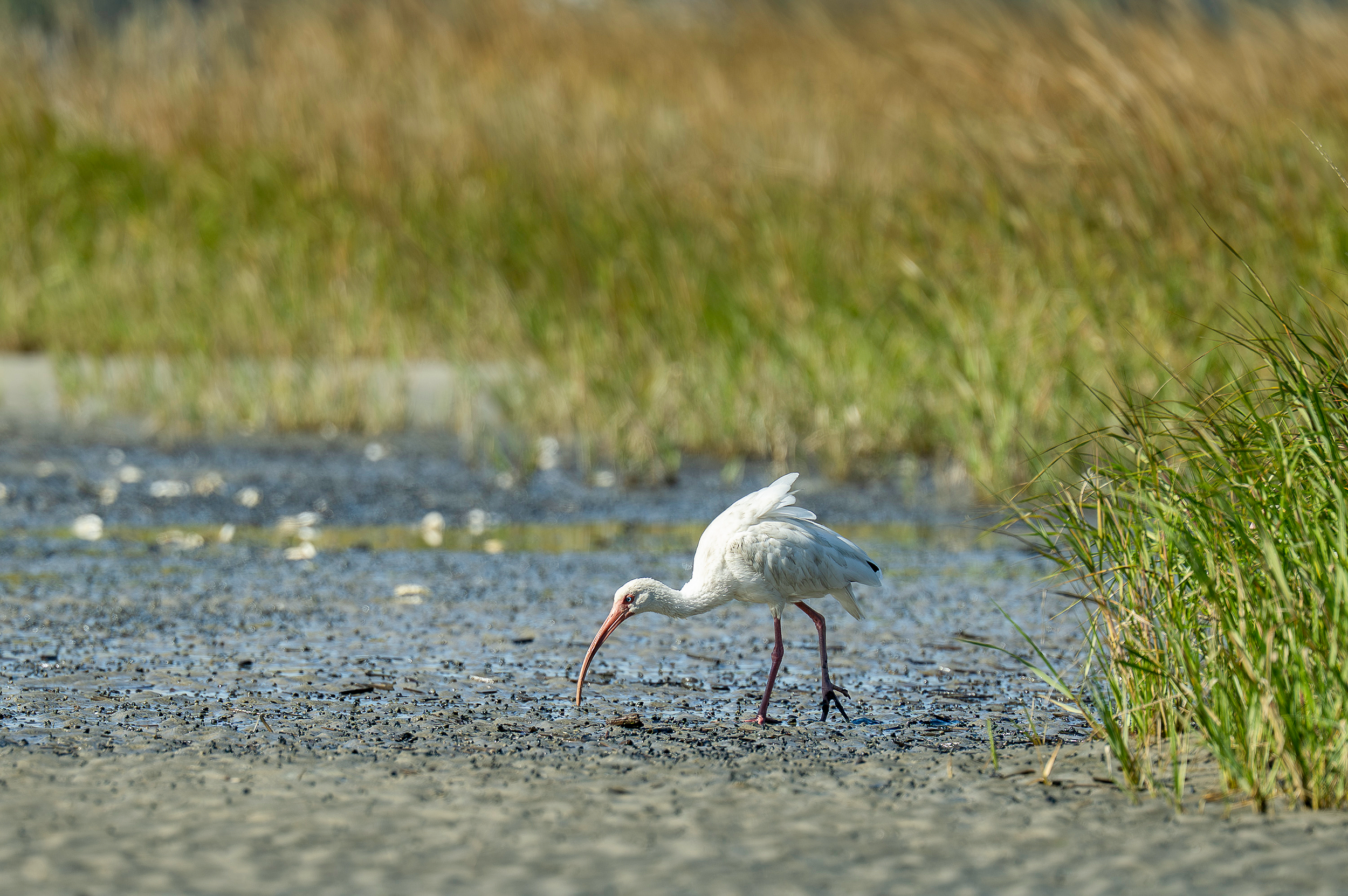
White Ibis feeding at high tide.
Shifting Shorelines
Watching their movements, it’s clear that the whole shoreline is connected by these daily changes. Each part of the coast—from delta to sandbar to marsh island—links together as safe places and feeding grounds. The shoreline isn’t just a place; it’s a series of spaces that depend on one another, held together by the tide and by the birds that follow its patterns.
What happens in one part of the shore affects the rest. The birds’ paths remind us that the health of the coastline depends on the full cycle—places to feed, places to roost, and the flow that connects them all. In the pattern of the tides and the movement of the flock, the interconnectedness of the coast is everywhere.
This post begins a year-long passion project for me, exploring how the shoreline of Hilton Head Island connects with neighboring coasts in South Carolina and Georgia. Over the next twelve months, I will be shadowing and documenting the survey work of Manomet shorebird biologist Allie Hayser, with a focus on Piping Plovers and Red Knots. This series won’t be a formal report, but an informal look at the daily work of shorebird biologists and what their observations can teach us about conservation. To learn more about the Georgia Bight Shorebird Conservation Initiative, visit the project page at Manomet: https://www.manomet.org/project/ga-bight-shorebird-conservation/
Not sure what to where birding the marshes and mudflats, read blog post: a Practical Guide to What to Wear Biding in the Lowcountry.
If you’d like to explore these habitats with a local guide, you can learn more about my guided birding and bird photography outings click here.
Hilton Head Island and the surrounding Lowcountry offer some of the best coastal birding on the Atlantic Flyway, and I’m always happy to help visitors and local residents discover the birds and habitats that make this region so special.
You can learn more about Hilton Head’s birds, habitats, and photography in my book Flight Through the Seasons, available on Amazon.
Disclosure: This post contains Amazon affiliate links. As an Amazon Associate, I earn from qualifying purchases.